 |
| Left Chadron early heading north to Hot Springs South Dakota. |
 |
| The hot springs waterfall got our attention so we had to stop. |
 |
| Of course there is a Earthcache type geocache here. We had to get information from this plaque to complete the cache. |
 |
| Gazebo with water fountain. The water was warm coming out and tasted okay. |
 |
| It says: "Kidney Springs" in small rocks |
 |
| View of buildings across the creek from the Kidney Springs gazebo. |
 |
| Mary had to feel the warm water running down the creek on this 37 degree morning. |
 |
| Water fall from hot springs up above |
 |
| Warm water makes the moss grow year round |
 |
| Buffalo along the road at Wind Cave National Park |
 |
| More buffalo along the highway |
 |
| We decided not to stop and read the plaques here as the buffalo were using it for a scratching post. |
 |
| Entering the Black Hills National Forest |
 |
| Some areas had a lot of burned trees. |
 |
| Lots of rock formations along the road |
 |
| Pringle South Dakota Bike graveyard we saw from the highway and had to turn in. There is a geocache here but we couldn't find it. Too many places to hide. |
 |
| Old barn along the highway |
 |
| Mary always likes new trees being planted. |
 |
| Interesting building in Custer South Dakota |
 |
 |
| We stopped and found a geocache outside of the Crazy Horse Memorial. Decided we didn't want to spend $24.00 to visit since we didn't want to spend a lot of time here. |
 |
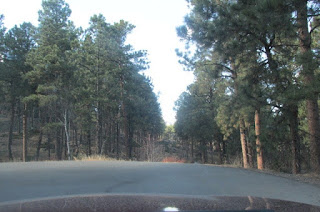
| Trees along the road in the Black Hills National Forest. |
 |
| Sylvan Lake. To complete the cache we would have had to walk around the lake and collect information. The wind chill was below freezing so we decided to skip it this trip. |
 |
| Beautifil scenery at Sylvan Lake. |
 |
| Pull off along the highway near the Needles Eye. |
 |
| View down the valley from the parking area. |
 |
| The Needles Eye. |
 |
| We needed information from this sign to complete the geocache. |
 |
| One of the tunnels we drove through. |
 |
| Another pulloff at the Cathedral Spires. |
 |
| Collecting information to complete a geocache. |
 |
| The Cathedral Spires. |
 |
| Finding another geocache along the road. |
 |
| Mountain goat at Mount Rushmore |
 |
| Expensive lunch at Mount Rushmore |
 |
| Mary talking to Megan after lunch below Mount Rushmore. |
 |
| A nice couple took pictures on our camera for us. We did the same for them. |
 |
| The museum at Mount Rushmore |
 |
| We had to collect information from the museum to complete the geocache at Mount Rushmore. |
 |
| A scale model of Mount Rushmore during construction. |
 |
| Iron Mountain Road southeast of Mount Rushmore. These are called pigtail bridges. They wind their way up the mountain instead of having to drive back and forth across the face of the mountain. |
 |
| All the tunnels were one lane only. |
 |
| Geocache along the road. |
 |
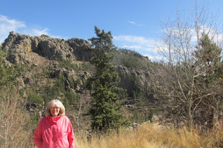
| Mary in her pink coat waiting for Jerry to hike back after finding the geocache across the valley. |
 |
| Getting closer to Mary in her pink coat. |
 |
| A lookout point along the road. We could see Mount Rushmore three miles away. |
 |
| Mount Rushmore in the background. |
 |
| Interesting rock formations along the road. |
 |
| Jerry going after the geocache just down the hill. |
 |
| View from below |
 |
| Finding another geocache along the road. |
 |
| Another tunnel with a geocache nearby. |
 |
| View of Mount Rushmore through the tunnel |
 |
| Mount Rushmore from three miles away |
 |
| Parts of the Iron Mountain highway are split to go around trees. |
 |
| Road coming back together. |
 |
| Keystone South Dakota |
 |
| Finding another geocache near the highway tunnel |
 |
| Red rocks along the highway to Rapid City South Dakota |
 |
| Sun Dial in a park in Rapid City South Dakota. Needed this picture to complete a geocache. |
 |
| Trying to tell what time is was from the Sun dial. It was an hour and a half off. |
 |
| Beautiful flowes at the park. |
 |
| A portion of the Berlin Wall that was brought to Rapid City to make this memorial at a local park. We needed this picture to complete another geocache. |


No comments:
Post a Comment